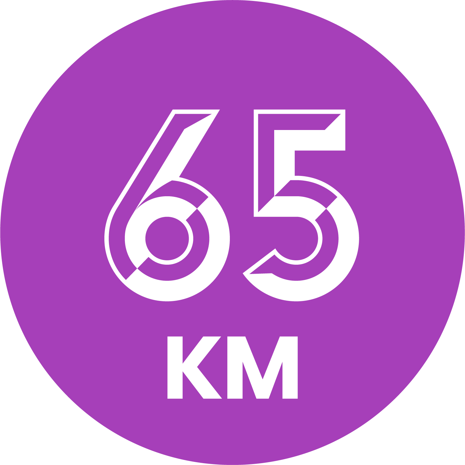
Trail 65 km


On the second longest distance, you first run over Vidden and pass the highest point of the trail, Hauggjelsvarden (674m above sea level).
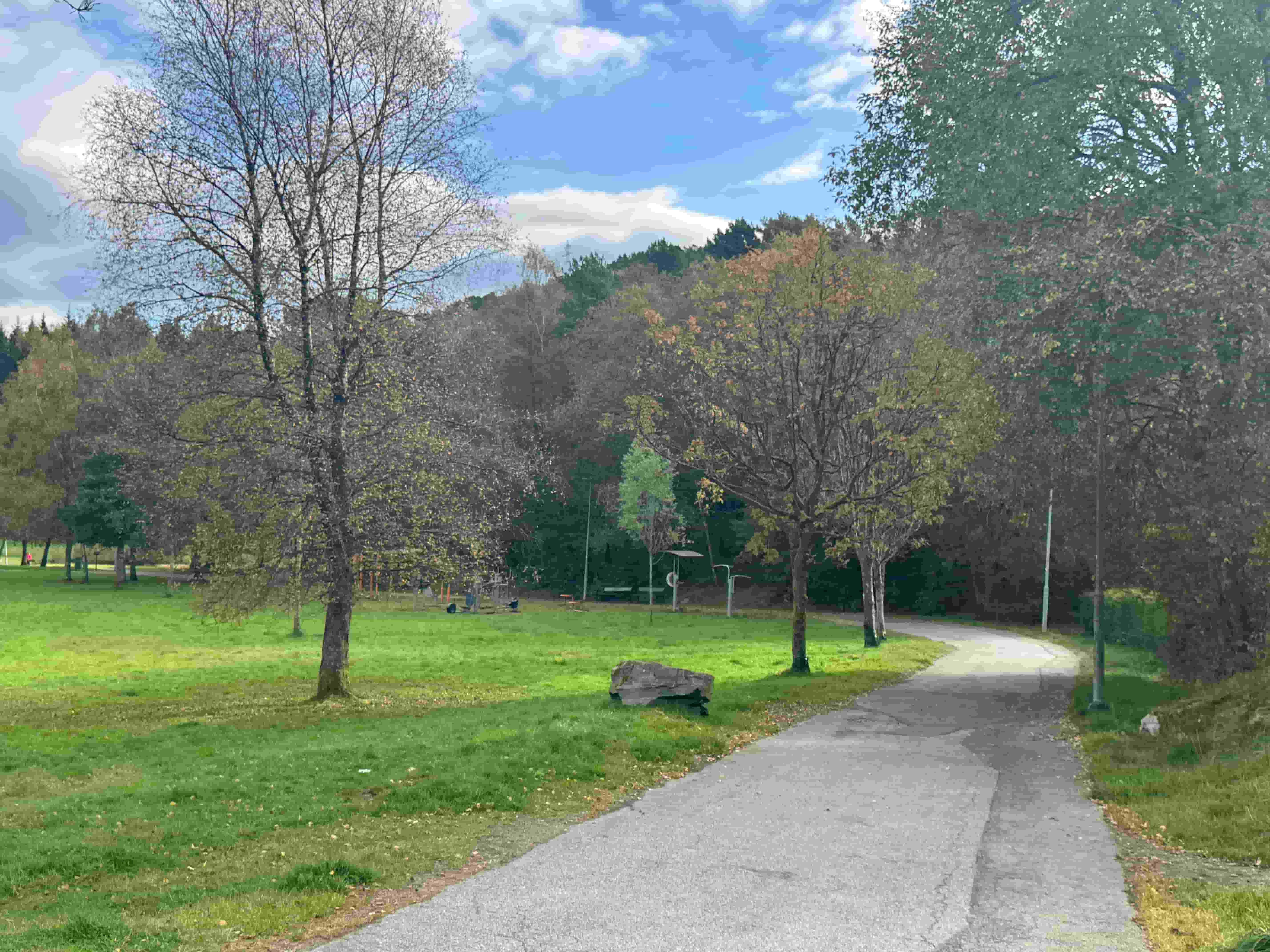
After arriving at the Viking cabin, the descent towards Åsane and Rolland begins. After a few kilometers on asphalt, you follow a path through a cultural landscape. From Ulsetvarden (288 m. above sea level) you have views both to the north and south, over central Åsane.
After some small marsh and path areas that may be wet, you continue through a plant field and onto a forest road, before it becomes a bit of asphalt again. Soon you are in a beautiful cultural landscape and pass Baugtveit, an old mountain farm. From there the trail goes on a gravel road to Baugtveitstemma, which was previously a reserve water source for Bergen municipality.
In the Falkanger area, the trail continues towards and over Veten (486 m above sea level), before you eventually descend back to Åsane – the district that became part of Bergen in 1972.
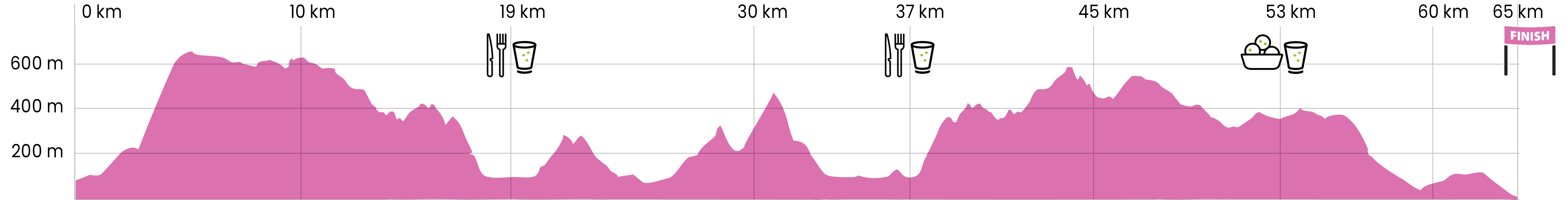
Drink and food stations:
After 19km and 37 km: Åsane - Cut off at 17:30
After 53 km: Fløien: Cut off at 20:30
Goal: 23:00
THE TRAIL
On the second longest distance, you first run over Vidden and pass the highest point of the trail, Hauggjelsvarden (674m above sea level).
After arriving at the Viking cabin, the descent towards Åsane and Rolland begins. After a few kilometers on asphalt, you follow a path through a cultural landscape. From Ulsetvarden (288 m. above sea level) you have views both to the north and south, over central Åsane.
After some small marsh and path areas that may be wet, you continue through a plant field and onto a forest road, before it becomes a bit of asphalt again. Soon you are in a beautiful cultural landscape and pass Baugtveit, an old mountain farm. From there the trail goes on a gravel road to Baugtveitstemma, which was previously a reserve water source for Bergen municipality.
In the Falkanger area, the trail continues towards and over Veten (486 m above sea level), before you eventually descend back to Åsane – the district that became part of Bergen in 1972.
Drink and food stations:
After 19km and 37 km: Åsane - Cut off at 17:30
After 53 km: Fløien: Cut off at 20:30
Goal: 23:00


PRACTICAL
Distribution of starting numbers
D-Day
Espelandshallen
The starting area is at Espelandshallen.
Three shuttle buses at 05:15 from Thon Hotel Rosenkrantz Bergen.
Rosenkrantzgaten 7, 5003 Bergen
Only for participants with a start number. Support will not be allowed on the bus.
08:00
Food and drink stations will be announced soon.

Drinks from start to first station:

Survival cloth

Mobile phone

Bank card/ID card

Payment method

Industry

Cup, soft bottle or similar
They did it!
Moments of achievement, community and emotion, captured in the heart of nature and in the heart of Oslo. Welcome to the world of EcoTrail.
Prepare for the race
Event rules
Race rules, race ethics and registration conditions
Our other races
Trail 91 km
Tough trail in beautiful nature
Trail 27 km
Not too long, not too short
Trail 12 km
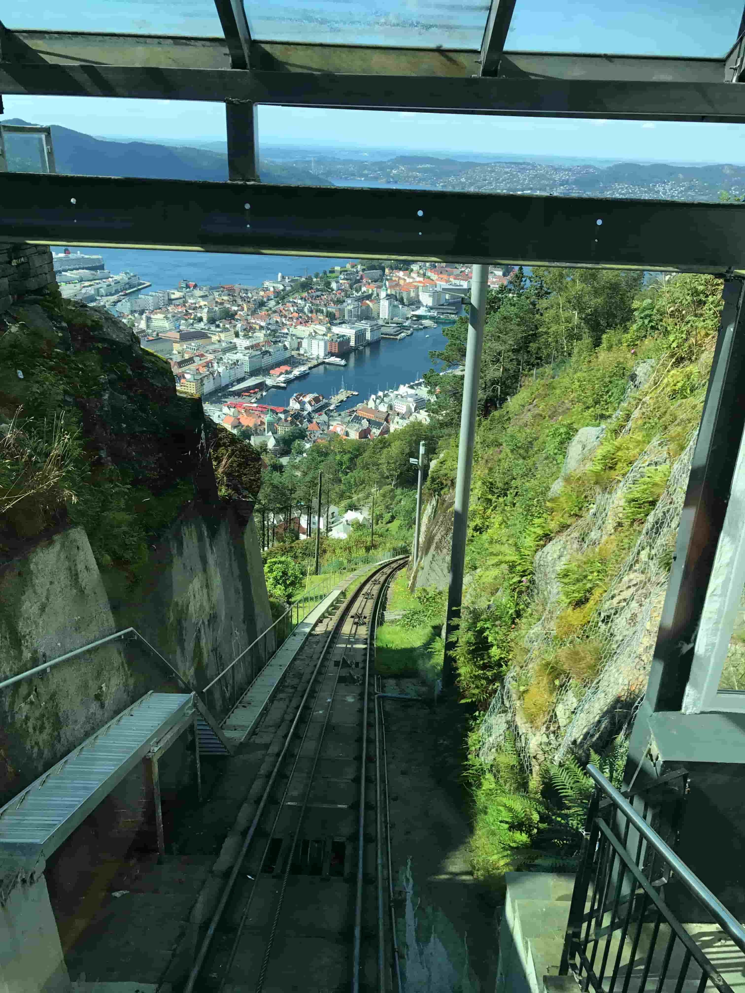
Amazing view